In 1695, John Mead, a Dutch weaver, joined Arent Schuyler, Samuel Berry, Hendrick and David Mandeville, George Ryerson, Anthony Brockholst, and Samuel Bayard on a venture to northern New Jersey, where they negotiated with indigenous Munsee-speaking people for the rights to 5,500 acres of land in the region on behalf of the English Crown.
When portions of this land were divided amongst the eight, Mead received lots in what is today the Mountain View section of Wayne. Mead died in 1714, leaving all his property to his wife, Margaret Mandeville Mead, to be divided equally amongst their four sons upon her death or remarriage. Though she did not die until 1745, the property was divided in 1740.
The Mead’s son Giles received a lot located at the modern-day intersection of Route 23 and Fairfield Ave. Archaeological evidence from this site suggests that a temporary sod house may have been built initially, and either Giles Mead or his son, Giles Mead Jr. built the Mead-Van Duyne House, likely post-1750.
In 1816, the property earned its contemporary name when Giles Mead Jr. sold the house and 160-acre property to his son-in-law, Abraham Van Duyne, and his daughter, Catherine Mead. Descendants of the Mead-Van Duyne couple owned the home until the early 20th century.
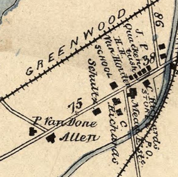
Mead’s Basin
The lots in southwest Wayne that were granted to John Mead in the early 18th century were initially, like much of Wayne, rural farmland. However, in the 1830s, the community saw an increase in development with the construction of the Morris Canal, built by the Morris Canal & Banking Company to carry coal from Pennsylvania to industrializing towns throughout New Jersey.
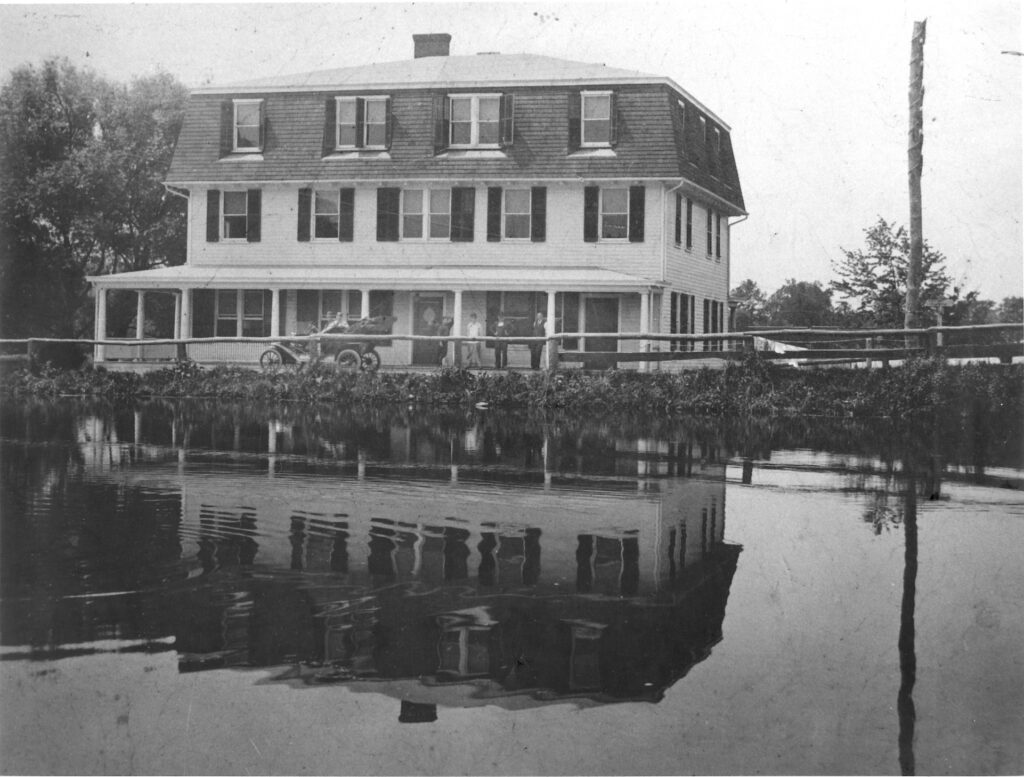
The canal ran alongside Wayne Township and intersected further with the construction of the Pompton Feeder in 1836; this connected the newly dammed Greenwood Lake with the main line of the canal. Passing directly through the historic Mead property, the Pompton Feeder connected the community with the Pequannock and Ramapo Rivers.
A basin was added, providing space where canal boats would be turned around or docked overnight, giving the community the name Mead’s Basin.
In Under the Sign of the Eagle, author William Berce cites an 1844 description of Mead’s Basin as “a small settlement and depot on the Morris Canal…where there are about a dozen dwellings.” Though small by urban standards, Mead’s Basin grew to accommodate the influx of canal travelers. General stores and hotels cropped up to cater to this population.
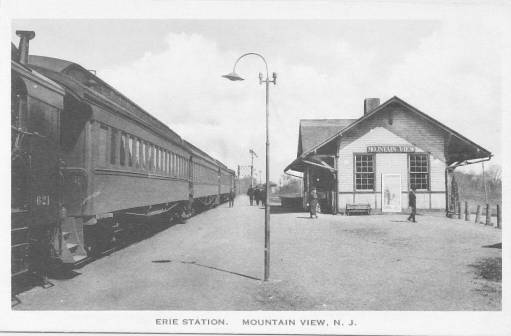
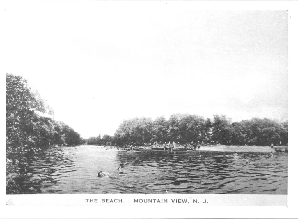
Though the Morris Canal was generally defunct by 1900, railroad lines introduced in the mid-19th century continued to bring visitors to the area. Mead’s Basin, renamed Mountain View in 1871, became known for summer tourism, offering canoeing, swimming, and camping to visitors from as far as New York City.
Archaeology at Mead-Van Duyne
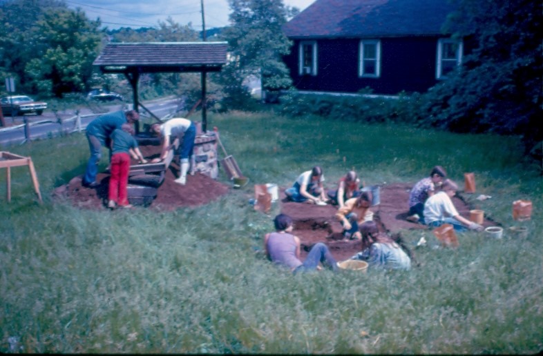
From 1973 to 1974, in anticipation of the expansion of Route 23, archaeologist Edward Lenik led an excavation of the Mead-Van Duyne House property, focusing on the indigenous inhabitants of the land. Remains of two fire pits were found on site, as well as a diverse range of artifacts: projectile points, stone tools- including scrapers, knives, flints, hammerstones, whetstones, and an ax-, pieces of shell, and ceramics fragments.
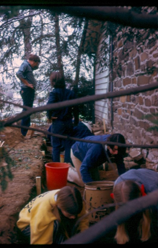
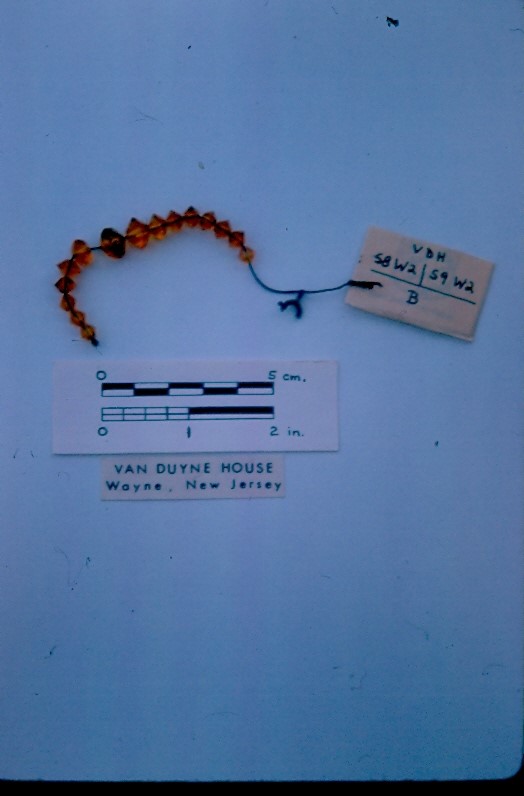
These discoveries led Lenik to determine that the site was likely occupied by indigenous peoples intermittently from 5000 BCE to 1600 CE. The Mead-Van Duyne property’s location in close proximity to a water source, with abundant natural resources, likely made it a popular waystation for hunting and gathering groups, a place for food gathering and processing, tool making, and pottery manufacture.
Larger ceramic fragments, coins, buttons, beads, and straight pins were also found on site, remnants of 18th- and 19th-century occupation.
Preserving Mead-Van Duyne
In 1947, the Mead-Van Duyne House was purchased by William and Florence Klein, who renovated and modernized the building. In 1973, however, the NJ Department of Transportation purchased the property from Florence Klein as part of preparations for the expansion of Route 23. While there was fear that the building would be torn down, the Wayne Historic Commission led a campaign to preserve the home.
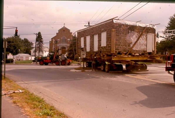
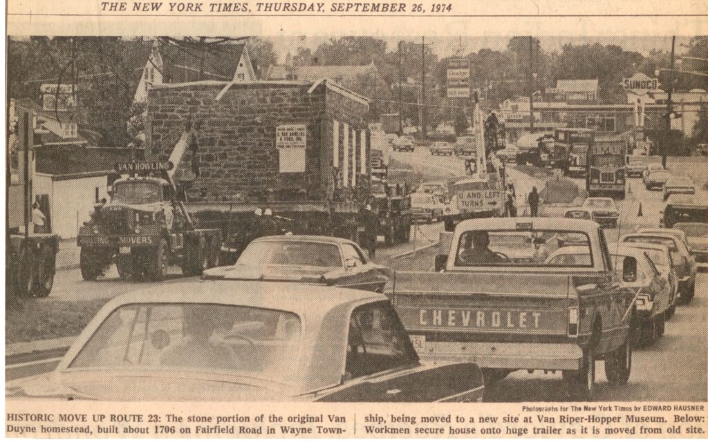
On September 25th, 1974, the home was uprooted and towed on dollies to its current location on the property of the Wayne Museum. The trip, which lasted over seven hours, took the home six miles down Fairfield Road, Route 23, Alps Road, and Berdan Ave; as part of the process, the home’s roof was removed so it could clear lower-lying power lines.
Today, the home is preserved at 533 Berdan Ave, though it is currently closed for renovations.

